
- 1,046
- 47
- 48
- Location
- Syracuse, New York
.
.
I assume a parachute is a military vehicle. I found an interesting Google Maps street view showing a 2014 USMC parachute training exercise near Okinawa. I found this after reading a CNN article about 9,900+ acres of US military base land the departing administration is giving away. As expected the article seems rather one-sided but it does offer a decent map of the various bases and a few interesting details. After some more research I see that the abandoned runway and modern commercial strip nearby were all part of the same USAAF base in 1945.
No political comments please.
Drop
https://www.google.com/maps/@26.721...Wn2OHNwJmXiCfthio3Zw!2e0!7i13312!8i6656?hl=en
Gate
https://www.google.com/maps/@26.725...kkPyBy8n9faOuqJ-Q1xw!2e0!7i13312!8i6656?hl=en
Ariel view
https://www.google.com/maps/@26.7289166,127.7667845,2267m/data=!3m1!1e3?hl=en
CNN article w/ decent map of US bases
http://edition.cnn.com/2016/12/21/asia/japan-okinawa-land-handover-us-military/index.html
Map of USAAF strips in 1945
https://en.wikipedia.org/wiki/United_States_Army_Air_Forces_in_Okinawa
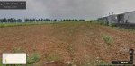
Image below
View attachment 659218
.
I assume a parachute is a military vehicle. I found an interesting Google Maps street view showing a 2014 USMC parachute training exercise near Okinawa. I found this after reading a CNN article about 9,900+ acres of US military base land the departing administration is giving away. As expected the article seems rather one-sided but it does offer a decent map of the various bases and a few interesting details. After some more research I see that the abandoned runway and modern commercial strip nearby were all part of the same USAAF base in 1945.
No political comments please.
Drop
https://www.google.com/maps/@26.721...Wn2OHNwJmXiCfthio3Zw!2e0!7i13312!8i6656?hl=en
Gate
https://www.google.com/maps/@26.725...kkPyBy8n9faOuqJ-Q1xw!2e0!7i13312!8i6656?hl=en
Ariel view
https://www.google.com/maps/@26.7289166,127.7667845,2267m/data=!3m1!1e3?hl=en
CNN article w/ decent map of US bases
http://edition.cnn.com/2016/12/21/asia/japan-okinawa-land-handover-us-military/index.html
Map of USAAF strips in 1945
https://en.wikipedia.org/wiki/United_States_Army_Air_Forces_in_Okinawa
Image below
View attachment 659218
Attachments
-
 47.7 KB Views: 25